How To Learn Marine Navigation (Easy In-Depth Guide)
Learning marine navigation can seem difficult, but when you break it up, it's actually pretty simple. Below, I'll go over the exact steps of learning marine navigation quickly.
How to learn marine navigation? In order to learn marine navigation, you need to understand how to locate your position (using bearings, GPS, stars, etc.), how to read nautical charts to determine a course, how to plot a course on a nautical chart or chartplotter, and how to use a compass (in order to monitor the course).
This still might seem like a lot. Don't worry. I have written detailed articles on all of these different steps. Below, I'll summarize the main takeaways for each step, and link to other articles so you can explore in more detail on your own. Ultimately, marine navigation all boils down to the way you get your lines. Let me explain.


On this page:
Fundamentals: how marine navigation works, how to use a boat compass, how to read and use nautical charts, my recommendation for a chart navigation course, my recommendations for navigation gear.
You first have to understand the fundamentals of marine navigation. Marine navigation consists of three very simple steps:
- Locate your position
- Determine a course
- Monitor the course
If you say it like that, it doesn't seem so difficult after all, right? There are all kinds of ways to locate your position, to determine your course, and to monitor the course. That's what makes it seem difficult. But in the end, it's always these three steps. For example:
- You locate your position by using GPS
- You determine a course based on a nautical depth chart and the wind direction
- You monitor the course using a compass or your GPS
Locating your position can be done with any kind of directional line, for example using landmarks, buoys, stars, or satellites (which is GPS).
Your navigation technique is simply the way you choose to get your lines. It is always recommended to have multiple ways of determining your location, just to be safe in case you have some sort of system failure.
Find all types of marine navigation in my in-depth guide here
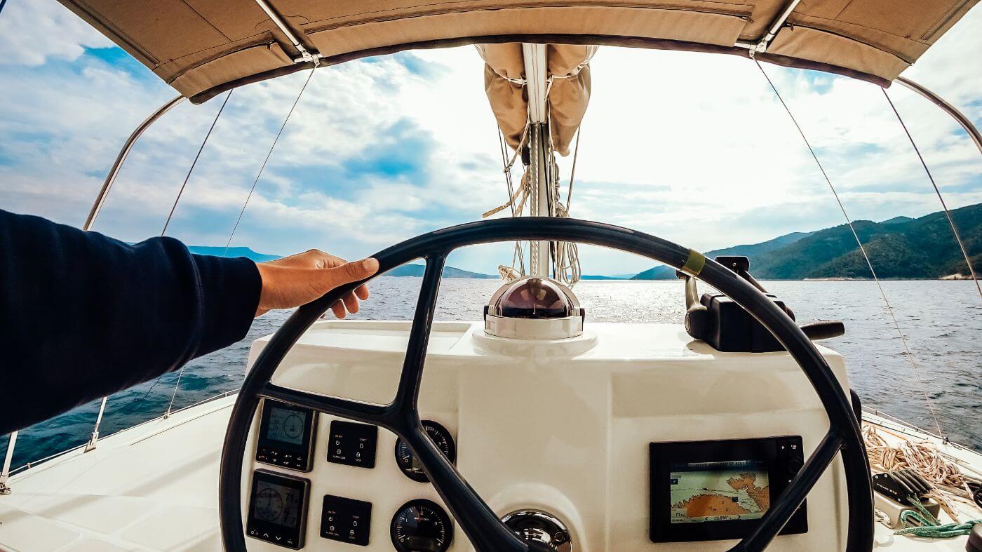
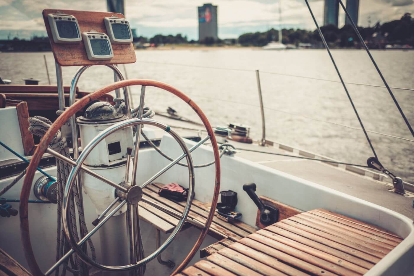
Using a boat compass may seem straightforward, but many people make mistakes that are easily avoided. Especially if you're just starting out, it's easy to make mistakes that may have large consequences.
The most common compass is the magnetic compass, which will work 99% of the time. There are situations in which a GPS compass may malfunction. Same goes for the magnetic compass. Having at least one extra back up compass is therefore recommended. Most sailors agree that a solid magnetic compass is the default choice for reliable navigation.

So how do you actually use a boat compass?
- The lubber line (a small line on the compass) marks your direction on the compass card.
- The direction is given in degrees.
- You pick a course on a nautical chart.
- Then, you steer the boat so that the lubber line points to the correct degree on the compass card.
- You keep course by making sure the lubber line stays put.
Most important compass lessons:
- Before leaving the marina, always check your compass' alignment
- Remember or record your reciprocal course - the opposite direction of your course current course. The reciprocal course will always get you home.
- A compass is still an important tool, even with GPS, since a compass tells you direction, not just track.
- You should mount your compass away from metals and electronics, otherwise it will deviate
- You should calibrate (swing) your compass after mounting
The compass will always point to magnetic north. However, the position of magnetic north changes all the time (less than 6 meters per year on the surface). The closer you get to the poles, the larger the navigational error margin becomes.
It's important to understand your compass well If you're new to sailing, I highly recommend reading up on the compass and learn how to use it the right way in this article .
We understand our compass and have a sense of the fundamental concepts of marine navigation. Now it's time to take a close look at nautical charts. William has written a very good series of articles on using nautical charts.
Here's the entire series in the recommended reading order:
- Nautical Chart Types Explained
- Ultimate Guide to Nautical Chart Navigation
- How To Plot a Course on a Chart
William is an experienced sailor (he has sailed the world for eight years) so he really knows what he's talking about. After reading this series you will be up to speed on chart navigation. If you're currently just orienting, I will summarize each article and talk about the takeaways below.
Different types of nautical charts
The most common type of nautical charts are navigation charts , which is what most people refer to when they talk about nautical charts. You'll be using navigation charts most of the time, although there are some other types like pilot charts.
A navigation chart is like a road map, with one important distinction: road maps contain roads, nautical charts don't. Nautical charts are more like geographic maps, showing depths, ridges, islands, shallows and similar features. They also contain important landmarks you can use to determine your position.
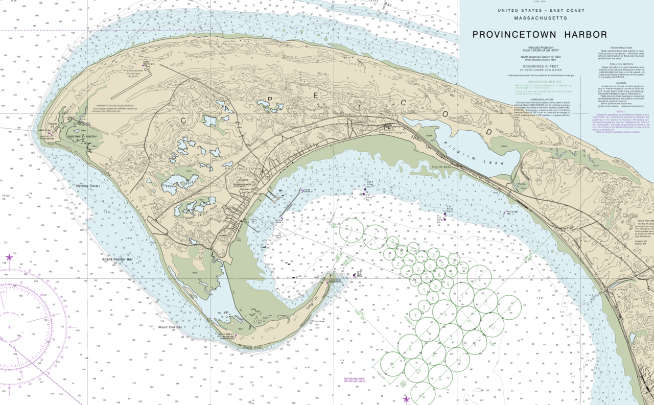
When using a chart, you want to pay attention to the scale. Typically, you want to use the largest scale charts possible , since those contain the most details. These are called large scale charts, coastal charts, general approach charts, or harbor charts. Smaller-scale charts are only useful for planning long voyages. You have to be careful with those since they won't contain every shallow or reef.
For an illustrated overview of the different nautical chart types , I recommend reading this article on chart types .
How to use nautical charts
Using nautical charts is as easy as pie - if you know what each symbol means and how to interpret the excess of information on there. In William's Ultimate Guide to Nautical Chart Navigation , he walks you through each and every item on there, with examples so it's easy to understand.
What you'll need to know in order to navigate safely:
- Navigation basics - what basic tools we have to navigate
- How to read a chart - interpreting all the information on the chart
- How to use a chart - plotting a course
How to read nautical charts
Generally, you'll find the following information on a good chart:
- Latitude and Longitude Lines
- Scales, Depths, and Notes - tides and currents, navigational marks
- Compass Rose - indicates the orientation of the map
- Depths and Contours - small numbers that state the depth of the bottom
- Symbols, Marks and Lights - things like hazards, landmarks, lighthouses
For a detailed explanation of each of these, go read the full guide on nautical chart navigation .

Coordinates
When navigating using nautical charts, we use coordinates to indicate positions. Coordinates consist of a latitude and longitude line. Charts have a geographic coordination scale which you can use to find these lines. Top and bottom of the map show longitude. The sides of the map show lattitude.
Symbols, Marks and Lights
You can find an overview of all the symbols and marks on the U.S. master list, which you can download here:
Download the US Chart Number 1 here (pdf )
Plotting a course on a nautical chart
Now you have the right chart, next up is plotting a course on it. You can use a chartplotter, which is essentially a GPS with a map underneath which does the plotting for you. However, it's still important to learn how to plot yourself, since electronics can (and will) fail at one point or another.
Getting good at plotting takes a bit of practice and an ordered routine. Once you get it down, however, it becomes a piece of cake.
You need three basic navigation tools: a parallel ruler, dividers, and the chart itself.
How to plot a course on a chart:
- Draw a line from point A to B - using parallel rules, from starting mark to next mark
- Check the line for safety - if not, move end mark until you get a safe leg
- Measure and mark the heading - transfer the leg to compass
- Measure and mark the distance - measure the legs
- Repeat until you get there
For more explanation on these steps, please read our article How To Plot a Course on a Chart (Illustrated Guide ).
When you're ready to master chart navigation, I recommend you check out the Coastal Navigation course at our partner NauticEd. It is quite excellent. They cover chart navigation in-depth and will guide you through multiple quality exercises to make sure you really practice your new skills. It is really affordable as well.
You'll leave Coastal Navigation Clinic with an understanding of:
- The Charts and how to use navigation tools
- True north and magnetic north - and variation and deviation
- Determining your position using various techniques such as dead reckoning, running fixes and triangulation
- What to do with your GPS position to get you to your destination
- Set and drift from wind, tides and current
- How to simply determine your heading based on Set and Drift
Check out NauticEd's Navigation Clinic now .
If you're ready to start navigating but are unsure what kind of equipment you should get, you should check out my recommendations. I have previously recommended a good beginner chartplotter, handheld GPS, and boat compass.
My recommendation for a boat compass
I recommend the Ritchie Navigation Explorer (click to check current price on Amazon ) - This compass is competitively priced, good looking, simple, reliable and rugged. Bracket mount (which I like). Also called the B51, it's the all-round best compass for most people. Best bang for the buck.
If you want to read the whole review, you can read my recommendation for a boat compass here.
My recommendation for a chartplotter
I recommend the Garmin echoMAP CHIRP 54cv (check current price at Amazon ) - This chartplotter is good for both inland and bluewater sailing, and made by the best-known brand for marine navigation in the world.
If you're looking for a budget handheld alternative , I'd consider the Garmin Striker 4 (check current price at Amazon ) - This simple handheld chartplotter offers mostly the same functionalities as the more expensive echoMAP, at a really competitive price. Incredibly, it also comes with a transducer, allowing you to use echo.
If you want to read the whole review, you can read my recommendation here.
Thank You Sir how does it feel when a huge wave is about to unravel you in sea when sailing
Leave a comment
You may also like, best marine compass: going the right way cheaply.
If you're serious about sailing, you know that a reliable compass can make all the difference. I've tested many compasses and read tons of reviews of other sailors, …

Best Marine GPS Chartplotter: My top pick for 2021
Please verify you are a human
Access to this page has been denied because we believe you are using automation tools to browse the website.
This may happen as a result of the following:
- Javascript is disabled or blocked by an extension (ad blockers for example)
- Your browser does not support cookies
Please make sure that Javascript and cookies are enabled on your browser and that you are not blocking them from loading.
Reference ID: f0b40745-2d95-11ef-9430-e667d001d1c7
Powered by PerimeterX , Inc.
Marine Navigation: How to Navigate a Boat

How to Navigate a Boat
- Decide on your method: electronic navigation or traditional (analog) navigation.
- If using electronic navigation, start by operating your GPS or chartplotter.
- Make note of your real-time position, speed and direction of travel.
- To get from point "A" to point "B," create a waypoint.
- String waypoints together to create a route; utilize auto-pilot when applicable.
- For traditional navigation, use: a compass, charters, parallel rulers and dividers.
- Stay within sight of land and use major landmarks as points of reference.
Electronic Marine Navigation
Thanks to modern tech, navigating with a modern GPS/chartplotter is a piece of cake. You can pull up an electronic map (though mariners always refer to their maps as “charts”), which shows your real-time position, speed and direction of travel, and more.
Locating your position is as simple as looking for the boat icon and/or GPS coordinates on-screen. To get from point “A” to point “B,” all you’ll have to do is create a waypoint.
- Depending on how advanced your chartplotter is this might mean scrolling a cursor across the chart, then creating a waypoint by pressing a button.
- In other cases you might have a touch-screen and merely need to tap the position you’d like to create a waypoint at.
- Then, you’ll want to press a “go to” button (or give the screen a swipe, as appropriate for your chartplotter).
- With the navigation from your present position to the waypoint then initiated, the chartplotter will give you a compass course to steer. Most chartplotters also have one or more “steering screens” to choose from, which will display both the desired compass course and the one you’re currently following.
- Use the chartplotter menu to pull this steering screen up, and you’re ready to follow the unit as you steer an accurate course to the waypoint. You can also plot in multiple waypoints and string them together, into a “route.”
The most important thing about creating waypoints and routes and then navigating to them is to look closely at the chart, and make sure you won’t be trying to cross any major obstructions like a finger of land, restricted areas, or waters which may not afford your boat it’s minimum draft (how much water your boat needs to avoid running aground).

There are many other electronic items that assist in navigation, like radar and autopilots . But these are naturally a bit more advanced. What about using a navigational app on your cell phone? There are a number that can prove helpful to boaters, including a wide range of iOS boating apps and Android boating apps .
However, boats and cell phones don’t always mix well; the moist environment and risk of shock damage are ever-present, and cell phone coverage can be sketchy or non-existent in many boating areas. As a result, you should never rely completely on a cell phone for navigating a boat.
Traditional Marine Navigation
Electronics can and do fail, so it’s also important to gain a basic understanding of the tools you need for analog navigation, and keep them aboard your boat at all times. These include:
- Charts for the waterways you travel
Parallel Rulers
With these basics, as long as you’re within sight of land and major landmarks you can figure out where you are and where you’re going.
A compass tells you which direction your boat is heading in—north, south, east, or west – as measured in degrees relative to magnetic north. There are 360 degrees representing a full circle. Zero degrees on the compass is north, 180 degrees points south, it’s 90 degrees to the east, and 270 degrees leads to the west. So a glance at your compass tells you what direction you’re travelling in, at any given time. When you steer your boat to a specific degree on the compass to maintain a straight course, you call this your “bearing.” So if you’re cruising to a restaurant for lunch and it’s directly to your north, you’ll be steering a zero-degree bearing. If it’s to your south you’ll steer a 180-degree bearing, and so on.
Charts are simply maps of the water and waterways, with special marking for water depths, channel markers, lighthouses, and restricted areas. NOAA produces charts for US waterways which can be viewed online for free , but to get printed versions you have to purchase charts or books of charts (for larger areas) from a NOAA certified agent . You can also pick up charts and chart books for your local waterway in virtually any marine supply store.
Parallel rulers are two rulers attached by a pair of swiveling arms, so you can swing the rulers close together or far apart but they will always remain perfectly parallel. By doing so repeatedly, you can “walk” the rulers across a chart. Why in the world would you want to? Because it will allow you to determine the exact compass bearing of any course you may want to steer. All charts have a compass rose with all 360-degrees printed on them. Place the ruler on top of the chart, on the course line you’d like to steer. Then walk the rulers to the compass rose, and viola—you know what compass bearing you need to steer your boat on to run the course.
Dividers have two arms that are attached at one end, and can be pulled apart to different widths at the other end. These are used to measure distance. All charts have a key which shows scale by miles and nautical miles. Hold the dividers up to the scale and pull them apart until the arms’ width equals the chart scale for a mile or any increment of miles (it’s common to see one, five, 10, or even 20 mile increments depending on the scale of the chart). With the dividers set you can then use them to measure the distance between any two points on the chart.

Marine Navigation Basic Tasks
With these tools in hand—or at the helm—you can accomplish the three most basic navigational tasks: figuring out where you are, where you want to go, and following a course to get there.
Where is Your Boat?
- To figure out where you are, look around and locate three charted landmarks like navigational aids, bridges, or water towers on shore.
- Point your compass (which means pointing your boat, unless you have a handheld compass) at them one at a time.
- Record the bearing.
- Then set your parallel rules on the compass rose so it matches the bearings and, one by one, walk them until they intersect with the landmark for the corresponding bearing and draw a line down the edge of the ruler.
- After doing all three lines, they will intersect to create a small triangle—and that’s your location.
How to Navigate to Where You Want to Go
This is just a matter of identifying your location and destination, then determining the corresponding compass bearing between the two places. Set your boat’s compass to match the bearing, and you’re ready to get underway.
Following a Course
Now that you know how to get a bearing, following the course is easy—all you have to do is steer the boat to keep the compass on that bearing. You’ll notice that keeping a boat on course can be difficult, especially with smaller, faster boats, and if you can keep your path within five or so degrees of the intended course you should consider it a job well done. Now get out there, and navigate!
Read Next: Boating Safety Guide
You Might Also Like:
- How to Dock a Boat
- How to Use a VHF Radio
- Weather Safety Tips for Boaters
- Pre-Departure Checklist
- Explore Boat Types

Join Our Newsletter!
Get community news, buying bargains, and how-to guides at your fingertips.
- BOAT OF THE YEAR
- Newsletters
- Sailboat Reviews
- Boating Safety
- Sails and Rigging
- Maintenance
- Sailing Totem
- Sailor & Galley
- Living Aboard
- Destinations
- Gear & Electronics
- Charter Resources
Planning a Sailboat Electronics Upgrade
- By David Schmidt
- Updated: May 19, 2021

Contemporary electronics can add a lot to a cruising sailboat. For starters, the gains often include easier-to-understand information, and therefore better situational awareness and increased safety. The catch, however, is that new plotters, radars and other instruments can be expensive, both to purchase and have installed. And then there’s the issue of getting new equipment to interface with older-but-still-functional gear. Because of this, plenty of cruisers manage just fine with older electronics that—while dated—still work and help get them from here to there.
But, as with all things marine, even once-high-end equipment eventually reaches its endgame. Trouble is, determining when checkmate is inevitable isn’t always obvious, so I reached out to two experts—Nigel Barron, sales and marketing manager at Seattle’s CSR Marine ( csrmarine.com ), and Rufus Van Gruisen, owner of Cay Electronics in Portsmouth, Rhode Island ( cayelectronics.com )—to learn more about when it’s time to (literally) pull the plug on old kit. In doing so, they also helped shed light on the performance and safety gains that can take the sting out of new-equipment purchases.
“Electronics typically work or don’t,” Van Gruisen says, adding that shy of a catastrophic event such as a lightning strike, obsolescence is the biggest gravedigger for most marine instruments. For example, Van Gruisen points to chart plotters: “New charts often don’t work on older plotters because they take up too much memory. A lot of products become obsolete because they can’t load modern software. A cruiser would need to find old, out-of-date charts to make it work.”
This might suffice in places such as Maine, where the seafloor is generally stable and where up-to-date cartography sometimes relies on old bathymetric surveys, but this certainly doesn’t hold true for places such as Chesapeake Bay or the Bahamas, where seafloors morph with storm events and time.
Another vintage-equipment killer, Van Gruisen says, is that manufacturers eventually stop supporting updates for older electronics. For example, older chart plotters can eventually stop working with current GPS configurations.
Barron agrees that obsolescence can be a problem; seven years, he says, is a reasonable life span for most electronics. He points to issues such as inconsistent data from sensors or transducers, speed information failing to display, or screen pixels going dark as signs that it could be time to upgrade. Plus, he believes, seven years is enough time for the market to offer significantly better products. “A cathode-ray tube television might still work, and an older radar might still work, but there are way-better products available that offer better reliability, lower power consumption and new features.”
Prime examples of this are digital, solid-state Doppler-enabled radars that depict dangerous targets in one color (typically red) on a chart-plotter display, and stationary or benign targets in another color (typically green or blue). This functionality not only makes it easier and more intuitive to read a radar display, but these radars are also designed to overlay this imagery atop cartography on a chart-plotter screen, thus improving the user’s situational awareness.
“In 2010, radar was analog,” Barron says. “In 2021, it’s digital.”
While these technological gains are to be celebrated, especially by cruisers who have plied waters shrouded in Down East pea-soup fog or Pacific Northwest rain, adding a modern Doppler-enabled radar to an older marine-electronics ecosystem isn’t usually a plug-and-play possibility.
“If an owner wants a new peripheral sensor attached to the chart plotter, they might need to replace the plotter,” Van Gruisen says. “It’s sometimes hard to replace one piece of electronics because it might not integrate with other equipment on the boat.”
Because of this, both Barron and Van Gruisen point to a new chart plotter as the place to start for refits both mighty and modest. “If you’re on a budget, you can buy a plotter and add sensors later,” Barron says. “It all starts with the plotter.”
Another common roadblock to easy upgrades involves data networks. While the older NMEA 0183 network protocol allowed discrete instruments to share some data, newer NMEA 2000 (commonly referred to as N2K) data backbones make it easy for owners to add new equipment to their network with considerably less fuss. Moreover, most new equipment is designed and built to work with N2K networks. While manufacturers still commonly support NMEA 0183 by making equipment “backward compatible” or by making an NMEA 0183 version of a new piece of equipment, this could change as N2K becomes increasingly dominant.
The problem, Barron says, is that converting to N2K “isn’t something that’s done in a vacuum. It’s part of a larger installation. There are upfront costs, but it will save you money down the road because it makes it easier to add new equipment.”
Another game-changer that both Barron and Van Gruisen agree on is the advent of the automatic identification system, or AIS. While recreational-level AIS has existed since 2006, recent years have seen a massive embrace of this technology by mariners of all stripes.
“The rate of uptake took us all by surprise,” Van Gruisen says. “AIS is now more useful than radar. It won’t protect you from all targets in pea-soup fog, but it’s easier to read than radar.” This is especially true if AIS targets can be overlaid atop cartography on a chart-plotter screen. (Or better still, overlaid atop radar and cartography.)
“AIS is a fraction of the cost of radar,” Barron says, adding that AIS costs roughly $1,000, while a new radar can fetch $3,000. Moreover, he says, falling prices have also encouraged mariners to embrace newer technologies. “The price difference between an AIS receiver and an AIS transceiver has become so narrow, why not transmit your position?”
While AIS and Doppler-enabled radar are two great examples of modern technologies either usurping older gear (such as analog magnetron radars) or revolutionizing marine safety (in the case of AIS), there are other gains to be had by upgrading, especially as prices on no-longer-bleeding-edge technologies fall. Some examples of this include forward-looking sonar, side-scanning sonar, thermal-imaging cameras, and bigger, easier-to-use screens and user interfaces.
“For Alaska cruising, it’s nice to have something more than a numerical representation of depth,” Barron says, noting that more adventure-minded cruisers are investigating forward-looking sonar. Van Gruisen agrees, adding that some Bahamas-bound clients who want to navigate through skinny waters have been gravitating toward forward-looking and side-scanning sonar.
Other new technologies worth a look include Raymarine’s ClearCruise AR (the “AR” stands for augmented reality), which uses cameras to place AIS-like tags above aids to navigation and other targets on a video feed that’s displayed on the chart plotter. And then there is B&G’s SailSteer, which takes numerical instrument data—apparent wind angles, true wind direction and course over ground—from the boat’s nav system and creates an easy-to-read onscreen graphical representation of the wind, which can make sailing easier and safer.
“I don’t see people coming in saying, ‘I want ClearCruise AR,’” Van Gruisen says. “But when it’s time for an upgrade, that’s the kind of technology they’re looking at.”
Ultimately, Barron says, sailors typically upgrade their electronics for two reasons: “Things break, or they go out on their friend’s boat and realize that it’s time to get out of the Stone Age.”
Should either of these descriptors apply to your sailboat, the good news is that today’s electronics offer far-better user interfaces, situational awareness and safety features than old-school gear. And while there’s no escaping the associated upgrade costs, this investment should deliver a significantly better time on the water.
David Schmidt is CW’s electronics editor.
- More: Electronics , Gear , print 2021 april

PredictWind Introduces PredictCurrent App

Musto’s MPX Impact is Made for Offshore

Awlgrip Unveils 3D Color Visualizer

Weems & Plath Introduces BrightWind

ACY Yachts Expands to the West Coast

Requiem for a Mate

How We Built Our Own Bulwarks

Sailboat Preview: Neel 52
- Digital Edition
- Customer Service
- Privacy Policy
- Email Newsletters
- Cruising World
- Sailing World
- Salt Water Sportsman
- Sport Fishing
- Wakeboarding

Navigation for the modern boater
The ultimate navigation display. Made for sunshine.

Advanced boat integration. Pinpoint accuracy. Total control.

The latest updates

Orca Boat Electronics Report
Learn which sensors, autopilots, and gateways boaters have onboard.

Remote Access
Check your vessel’s status from anywhere

Introducing Rerouting for Sail Routes
A new approach to navigation for sailboats

How can we help?
Contact us by phone, chat, or email – or learn about Orca with guides and articles.

2024 © Orca. All rights reserved.
- $ 0.00 0 items
History of Navigation: Old Navigational Instruments and How They Were Used
You may be a navigational whiz in your neighborhood or a surrounding city, but what if you take a step further? Let’s face it – in an unfamiliar place, it’s easy to get lost, even with an understanding of the landmarks. To remedy this, traveling merchants and explorers alike have developed several ways to navigate, despite the challenges our vast environment poses.
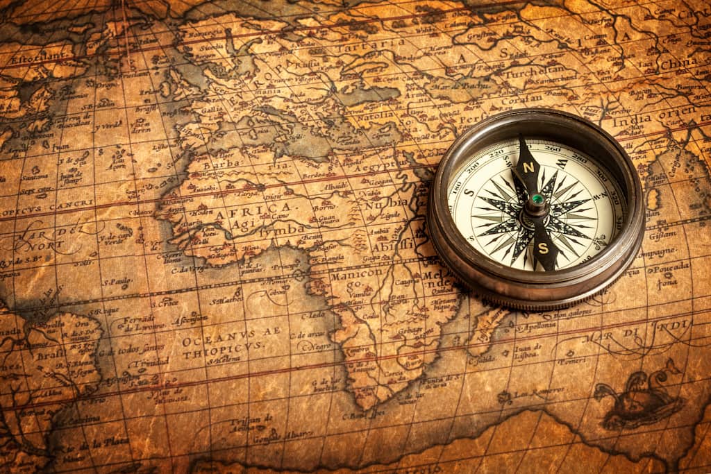
Since the beginning of time, the sun has been used as a means of direction based on the time of day it signifies. Since then, we have gathered more knowledge on the positions of the moon, stars, and planets that have further enhanced our understanding. The history of navigation goes way back, and the various instruments have developed greatly. To understand how we got from looking at the sun to world globes , to Google Maps, we are shedding light on the ancient navigation tools used through the years. Let’s dive right in!
Maps and Landmarks
landmarks, on the other hand, are another common navigational instrument. Nearly everyone has used a noticeable landmark to find their way, whether it’s visible in front of them, or something that has been spoken about for generations. These are particularly useful when it comes to navigating the land, as well as some small bodies of water, but when it comes to naval navigation tools, landmarks are not particularly beneficial.
One of the most commonly known old navigational instruments is the compass. The magnetic compass was first invented in China in the 3rd century BCE, yet wasn’t utilized for navigational purposes for another thousand years.
Unlike compasses today that point to the North Pole to provide a sense of your location and direction, early compasses actually pointed to the Southern Pole – a change that developed over the years for modern users.
The Lead Line

So, how did this help with location? In some practices, a ball of animal fat in the weight could bring up material from the ocean floor, which helped knowledgeable sea experts look at the dirt and sand to understand their location.
Lead lines, and their modern alternative, the log line, are still used in some rivers and waterways today. They remain a useful tool when dealing with unpredictable and seasonal changes in the water’s depth.
The Astrolabe
Another key tool when examining the history of navigational instruments is the astrolabe.
The term astrolabe means “to take a star” or “star taker.” While it’s not known for sure where this tool originated, it grew in popularity in the Roman Empire and was used for many years. While it is not relied upon today, it is still a reliable tool, particularly for those interested in astronomy.
In later uses, the astrolabe was used beyond astronomy as a tool for sailors, and thus dubbed the mariner’s astrolabe. Sailors could use this tool by lining it up with the sun or a specific star in relation to the horizon to understand latitude vertically. This helped them determine their location while at sea.
Nowadays, we see the astrolabe used as a decoration piece, as the design can be particularly aesthetically pleasing. This tool can come in a few shapes, such as a sphere, or also as flat plates and disks. It has been made in a range of different materials, and can even come in a quadrant shape.
The Sextant

First appearing in the late 1700s, the sextant was one of the more bulky ancient navigation tools. Thankfully, through the yeast, scientists managed to create smaller versions. Primarily utilized by astronomers to measure the distance between celestial objects, that was also one of the common naval navigation tools used to record a sailor’s journey. Today, sextants are still required on both ships and planes to determine longitude and latitude.
Navigational Instruments: A Guide to Essential Tools for Accurate Navigation
by Emma Sullivan | Jul 20, 2023 | Sailing Adventures

Short answer navigational instruments:
Navigational instruments are tools used to determine and track a vessel’s position and direction in the water or aircraft’s position in the sky. They include compasses, sextants, GPS devices, and radar systems. These instruments aid in safe navigation and help ensure accurate course plotting and waypoint identification.
Exploring the World: A Guide to Navigational Instruments
Title: Exploring the World: A Guide to Navigational Instruments
Introduction: Embarking on a new adventure is always thrilling, but without the right tools, it can quickly become a daunting task. In the realm of exploration and navigation, having the proper instruments is crucial for success. From ancient times to modern technology-driven explorations, navigational instruments have played a vital role in helping adventurers conquer uncharted territories and navigate vast oceans. In this blog post, we will dive into the fascinating world of navigational instruments, exploring their history, significance, and how they have evolved over time.
1. The Astrolabe: Unveiling Celestial Secrets Centuries ago, celestial navigation was an essential skill for sailors and explorers alike. The astrolabe was their go-to instrument for understanding heavenly bodies’ positions relative to Earth’s surface. With its ingenious design featuring a rotating disk indicating celestial coordinate systems and an adjustable sighting arm used to locate stars or other celestial objects, the astrolabe became instrumental in early navigational endeavors.
2. The Compass: Magnetic Magic No list of navigational instruments would be complete without mentioning the compass—a device revolutionizing seafaring and land exploration. Based on Earth’s magnetic field, this simple yet remarkably accurate instrument helped mariners find their bearings even when there were no visible landmarks in sight. Its ability to consistently point towards the Earth’s magnetic north made compasses indispensable tools that opened up new horizons of exploration for generations.
3. Sextant: When Stars Align with Precision Stepping into more recent history brings us to one of the most iconic navigational tools—the sextant—popularized during the age of sail. This beautifully crafted instrument allowed sailors to measure angular distances between two celestial objects (usually stars) or between a celestial object and the horizon line—a technique known as sextant observation or celnav (celestial navigation). By aligning these measurements with known data tables, sailors could determine their precise position on the globe, even amidst vast oceans.
4. GPS: A Technological Revolution In the digital age, global positioning systems (GPS) have taken navigation to an entirely new level. Satellites orbiting Earth transmit signals that allow receivers to calculate accurate positions anywhere on the globe within seconds. From handheld devices used by hikers to advanced systems guiding aircraft and maritime vessels, GPS has become an indispensable tool for modern-day explorers. Its widespread accessibility and unprecedented accuracy have undoubtedly revolutionized navigation.
Conclusion: Navigational instruments have played a pivotal role in humanity’s drive for exploration throughout history. From antiquated devices like the astrolabe and compass to sophisticated tools like the sextant and GPS, the evolution of navigational instruments has brought expeditions beyond what once seemed possible. Whether you’re adventuring through the cosmos or charting uncharted territories here on Earth, understanding these instruments’ rich history is a testament to our enduring human spirit of exploration. So as you don your adventurer’s hat and set out to explore this magnificent world, remember that with navigational instruments in hand and knowledge in mind, you too can follow in the footsteps of those who came before—adding your own chapter to mankind’s eternal quest for discovery.
Mastering Navigation: How Navigational Instruments Work
Title: Mastering Navigation: Unlocking the Secrets behind Navigational Instruments
Introduction:
Navigational instruments have played a crucial role in enabling humans to conquer the vast seas and skies. From ancient times to modern-day expeditions, these sophisticated tools guide our way as we explore uncharted territories. In this captivating blog post, we delve deep into the intricate workings of navigational instruments to unveil their hidden mechanisms and highlight their indispensable importance in mastering navigation.
1. The Compass: A True North Pointer:
The compass serves as a reliable companion for every explorer, ensuring accurate orientation even amidst featureless landscapes or deep oceans. Before uncovering its mystique, let’s clarify how it operates. Embedded within the needle lies an invisible force known as magnetism that aligns itself with Earth’s magnetic field. The magnetic needle always points towards the Magnetic North Pole, allowing mariners and adventurers alike to navigate with utmost precision.
2. Astrolabe: Guiding by Celestial Bodies:
Imagine unfolding centuries-old secrets of celestial bodies while navigating unknown waters! The astrolabe allows intrepid sailors to determine latitude by measuring the angle between the horizon and specific stars or celestial objects such as the sun or moon. This device elegantly combines artistry with practicality, featuring engraved celestial maps and movable rings facilitating astronomical calculations—all one needs to embark on a successful sea voyage!
3. Sextant: Pinpointing Your Location with Elegance:
Ahoy there! No journey across vast oceans would be complete without mentioning the sextant—a covetable instrument synonymous with maritime adventures. Combining proficiency with mathematical principles, this elegant brass object accurately measures angular distances between celestial bodies like sun or stars and the horizon line—illuminating one’s precise position using principles of trigonometry.
4. Electronic Chart Plotters: Charting Your Course Digitally:
In today’s technologically advanced era, electronic chart plotters dominate nautical navigation. Boasting color displays and real-time positioning, these clever gadgets integrate GPS satellite signals with navigational charts stored within their memory banks. They provide accurate position tracking, indicate obstacles or hazardous areas, and even suggest the optimal route to reach one’s destination—a true smart companion for any mariner!
5. Flight Navigation Instruments: Taking Skies by Storm:
When it comes to mastering navigation in the air, sophisticated flight instruments take center stage. From altimeters measuring altitude above sea level to gyroscopic attitude indicators that portray aircraft orientation relative to the horizon—precision and reliability are paramount for aviators. Integrated systems like GPS navigation units further enhance aerial navigation by providing real-time location data and advanced guidance.
Conclusion:
Mastering navigation is a fascinating blend of timeless craftsmanship, technological innovation, and intellectual prowess. Navigational instruments have not only accompanied explorers throughout history but also paved the way for new discoveries while ensuring safety on countless journeys. Understanding how compasses magnetically align themselves with the Earth’s core or how electronic chart plotters seamlessly combine digital mapping and positioning technology gives us a profound appreciation for these remarkable tools that continue to navigate us towards horizons yet unseen.
So set sail with your compass at hand or soar through skies equipped with essential flight instrumentation—discover the world confidently as you master the art of navigation!
Navigational Instruments: A Step-by-Step Guide to Effective Use
Welcome aboard our journey through the world of navigational instruments! Whether you are a seasoned sailor or a beginner looking to embark on your first maritime adventure, understanding how to effectively use these tools is vital. In this comprehensive guide, we will delve into the details of various navigational instruments, their functions, and provide you with invaluable tips to enhance your sailing experience.
1. Compass – The Timeless Navigator:
The compass has been an indispensable tool for sailors since its invention in ancient China. Its magnetic needle aligns with the Earth’s magnetic field, providing us with accurate readings of direction. When using a compass, it’s crucial to remember that it points towards magnetic north rather than true north (the North Pole). To compensate for this variation known as declination, be sure to adjust your course accordingly.
Top Tip: Remember the mnemonic “East is Least and West is Best.” If you’re going west, subtract the declination from your compass reading; if you’re heading east, add it.
2. Sextant – Celestial Navigation Unleashed:
For centuries before modern satellite technology emerged, sailors relied on celestial navigation techniques using a sextant. This handheld instrument uses mirrors and lenses to measure angles between celestial bodies (typically the sun or stars) and the horizon. By comparing these measurements with established mathematical formulas or nautical tables such as the Nautical Almanac, you can determine your position accurately.
Top Tip: Take multiple sightings and calculate an average for better accuracy when using a sextant.
3. GPS – Precision at Your Fingertips:
In today’s digital era, Global Positioning System (GPS) reigns supreme as one of the most user-friendly navigational tools available. GPS receivers rely on signals transmitted by satellites orbiting the earth to pinpoint your location accurately. Apart from revealing coordinates in latitude and longitude format, GPS devices provide valuable information such as speed, heading, and estimated time of arrival.
Top Tip: Always carry spare batteries or a backup power source for your GPS device to avoid getting stranded without navigation aids when on extended journeys.
4. Nautical Chart – Artistry Meets Precision:
A nautical chart is a sailor’s treasure map, providing comprehensive information about the seascape you’re navigating. These detailed charts depict water depths, seabed characteristics, navigational aids (buoys, beacons), and potential hazards like rocks or sandbars. Learning how to read and interpret nautical charts is crucial for safe navigation through often treacherous waters.
Top Tip: Keep your charts up-to-date by acquiring the latest editions or using electronic charting systems that have regular updates available.
5. Depth Sounder – Peering Beneath the Surface:
As its name suggests, a depth sounder measures water depth beneath your vessel in real-time. By emitting ultrasonic pulses and measuring the time it takes for them to bounce back, this handy tool allows sailors to assess underwater conditions and identify any potential dangers lurking beneath the surface.
Top Tip: To maximize accuracy, clean the transducer regularly and make sure there are no obstructions such as barnacles affecting its performance.
6. Radar – Piercing Through Darkness:
Radar technology operates on the principle of radio waves bouncing off objects in its path. This instrument proves invaluable whenever visibility deteriorates due to fog, rainstorms, or darkness – allowing you to “see” other vessels or obstacles long before they become visible through other means.
Top Tip: Understand how radar echoes can merge with landmasses — known as shadowing or hiding — leading to blind spots on-screen. Anticipate these limitations when planning your route accordingly.
So there you have it – our comprehensive guide to navigational instruments! Armed with this newfound knowledge of compasses, sextants, GPS devices, nautical charts, depth sounders, and radar, you are equipped to navigate the vast expanse of the world’s oceans with confidence. Remember, practice makes perfect, so embark on your adventure and continually refine your skills as a master of the sea!
Navigational Instruments FAQ: Answering Your Questions on Usage and Maintenance
Are you a seafarer, adventurer, or boat enthusiast who loves to navigate through the vastness of the ocean? If so, you must understand the importance of reliable navigational instruments. These tools are essential for safe and accurate navigation, ensuring that you steer your vessel with precision and avoid any potential dangers lurking beneath the surface. In this comprehensive FAQ guide, we will answer some of your burning questions about the usage and maintenance of navigational instruments. So grab your compasses and sextants as we embark on this enlightening journey!
Q1: How do I properly use a compass for navigation?
A: Ah, the humble compass – an age-old tool synonymous with navigation. To use it effectively, hold it horizontally in front of you and make sure it remains level. Ensure that there are no magnetic objects nearby that could interfere with the accuracy of the needle’s orientation. Once set up correctly, simply align the needle’s north end with true north or magnetic north (depending on your preference). Keep in mind that declination can affect accuracy; refer to appropriate charts or online sources to determine declination values for your location.
Q2: What is a sextant used for, and how does one operate it?
A: Ahoy! The sextant – an instrument often associated with old-world charm and seafaring romance! This nautical marvel allows mariners to measure angles between celestial bodies such as stars or planets and the horizon. To operate a sextant, first adjust its mirrors so that they reflect both the celestial body being observed and the horizon simultaneously into your eye at approximately 60°. Next, carefully maneuver until both images align precisely together (this position is known as “bringing them together”). Read off this angle on the scale provided – voila! You have successfully determined your position using celestial navigation.
Q3: How do I maintain my navigational instruments for optimal performance?
A: Ah, maintenance – the key to longevity and accuracy! Firstly, always keep your navigational instruments dry, as moisture can damage sensitive components. Regularly clean them with a soft cloth to remove any dirt or salt residue. After use, store them in a protective case to prevent exposure to harsh elements or accidental impact. For precision instruments like sextants, periodic calibration by a certified professional is recommended. Remember: caring for your tools ensures they serve you faithfully throughout countless voyages.
Q4: Are digital navigational devices as reliable as traditional ones?
A: Ahoy, mariners of the digital era! Digital navigation devices have certainly transformed the way we navigate today. While traditional methods remain valuable and romanticized, modern devices like GPS (Global Positioning System) offer unparalleled accuracy and convenience. Their electronic charts display real-time information on vessels’ positions, depths, and potential hazards. However, it’s vital not to solely rely on digital tools. Backup resources such as paper charts and traditional navigational skills must be maintained in case of power failure or technical issues.
Q5: Can I use my phone as a navigation tool?
A: “Ahoy Siri! Can you navigate us through these treacherous waters?” Yes indeed! Smartphones can function as capable navigation tools in conjunction with appropriate apps or software programs designed for marine use. These applications provide various features like chart plotting, tides information, depth soundings, and even weather updates—all in one device! However convenient they may be though; it’s essential to consider their limitations regarding battery life and water resistance – investing in a waterproof case is highly recommended.
So there you have it—our comprehensive FAQ guide on usage and maintenance of navigational instruments. By understanding how to properly use these tools while maintaining their proper upkeep, you can sail with confidence across the vast blue expanse knowing that you are equipped to navigate any challenge that comes your way. Happy sailing, fellow adventurers!
Choosing the Right Navigational Instrument: Factors to Consider
Are you embarking on a thrilling adventure across land or sea? Whether you’re venturing on a sailing expedition or planning an exciting hiking trip, having the right navigational instrument is crucial to ensure a safe and successful journey. With numerous options available in today’s market, selecting the perfect tool can feel overwhelming. Fear not, for we have compiled a comprehensive guide to assist you in choosing the right navigational instrument tailored to your specific needs.
1. Purpose: First and foremost, consider the purpose of your expedition. Are you exploring uncharted territories or simply navigating through familiar terrain? Understanding your intended use will help determine the level of sophistication required for your navigational instrument. For instance, if you’re an experienced mariner embarking on an oceanic voyage, a sophisticated GPS system with mapping capabilities would be essential. However, if you’re going on a casual hike through familiar trails, a simpler compass might suffice.
2. Accuracy: The accuracy of your chosen instrument is another crucial factor to consider. Accuracy varies based on different instruments such as maps, compasses, binoculars with rangefinders or even sextants for those skilled in celestial navigation. It’s vital that your navigational tool provides precise readings and reliable information to avoid getting lost or misinterpreting directions during your expedition.
3. Durability: When it comes to outdoor adventures, ruggedness and durability are paramount considerations for navigational instruments. The last thing you want is for your tool to break down in inclement weather or challenging terrains. Look for instruments made from sturdy materials such as high-quality metals or impact-resistant polymers that can withstand rough handling and varying weather conditions without compromising functionality.
4. Ease of Use: While some adventurers revel in complex instrumentation and intricate map-reading techniques, others prefer simplicity when it comes to navigation tools. Consider your comfort level with using specific devices – do you desire advanced features or uncomplicated functionality? Keep in mind that ease of use becomes even more critical in high-stress situations, so choose an instrument that feels intuitive and user-friendly to minimize the chance of errors when under pressure.
5. Backup Options: Even the most advanced navigational instruments can fail due to technical glitches or unforeseen circumstances. Therefore, having backup options is a smart move to ensure you’re never left stranded without any means of navigation. Consider adding redundant tools like a backup compass, paper maps, or even a handheld radio with GPS capabilities. Reliability is key when it comes to safety and peace of mind during your expedition.
6. Weight and Portability: Carrying unnecessary weight can add undue strain on your adventure, hindering your enjoyment and performance. Opt for lightweight navigational instruments that are easy to carry and won’t burden you during long treks or extended periods at sea. Additionally, consider their portability – will they fit comfortably into your backpack or sailing bag? Always prioritize convenience without compromising on functionality.
7. Cost: Last but certainly not least, budgetary considerations play a vital role in selecting the right navigational instrument for your needs. Price tags for these tools can range from modest to extravagant depending on their sophistication and capabilities. It’s crucial to strike a balance between affordability and quality – opt for the best instrument that meets both criteria within your financial limitations.
By taking these factors into account – purpose, accuracy, durability, ease of use, backup options, weight/portability, and cost – you’ll be well-equipped with the knowledge required to make an informed decision while choosing the perfect navigational instrument for your upcoming adventure.
Remember, proper navigation ensures not only successful journeys but also adds an extra layer of excitement as you traverse through uncharted territories with confidence and precision! Happy exploring!
From Compasses to GPS: The Evolution of Navigational Instruments
Navigation is an essential human skill that has been honed and developed for centuries. As explorers ventured into uncharted territories and sailors braved treacherous seas, the need for accurate navigational tools became increasingly apparent. Over time, navigating the vast expanse of our world evolved from relying solely on a simple compass to utilizing advanced Global Positioning System (GPS) technology. In this blog post, we will take a fascinating journey through time as we explore the evolution of navigational instruments.
Let’s step back in time to ancient civilizations when sailors relied on the stars above and landmarks on land to find their way. Back then, there were no fancy gadgets or satellites guiding their paths; it was all about observing nature’s cues. One of the earliest known navigational tools was the astrolabe, used by ancient mariners around 200 BCE. This ingenious instrument allowed sailors to measure the angles between heavenly bodies and calculate their latitude – an invaluable tool for anyone exploring new territories.
As civilization progressed, so did navigational instruments. The compass made its grand entrance during China’s Han Dynasty around the 2nd century CE and quickly revolutionized navigation. The simplicity yet precision of this magnetic instrument made it indispensable in guiding sailors across vast oceans. Mariners could now determine their direction accurately regardless of cloud cover or lack of visible landmarks.
Fast forward centuries later to the Age of Discovery, when ambitious explorers like Christopher Columbus set out on daring voyages that shaped our modern world. It was during this era that terrestrial navigation tools came into play. Devices such as quadrants and cross-staffs enabled sailors to measure angles between celestial objects and create more accurate charts for maritime travel.
While these early instruments certainly paved the way for successful exploration, they still relied heavily on human observation and interpretation which left room for error. However, with advancements in technology came more precise tools. In the late 18th century, the sextant emerged as a significant player in navigating the high seas, providing mariners with enhanced accuracy and reliability.
As we entered the 20th century, navigational instruments underwent yet another incredible transformation. The advent of radio waves brought forth radio direction finders (RDFs) – a device that allowed ships and aircraft to determine their bearings based on signals transmitted from shore-based stations. This breakthrough in communication technology provided unparalleled navigational assistance and greatly reduced reliance on celestial observations.
However, it wasn’t until the second half of the 20th century that we witnessed the most groundbreaking advancement in navigation – GPS. Initially developed for military purposes, Global Positioning System technology quickly found its way into civilian hands and revolutionized how we navigate. By employing satellite signals received by receivers on Earth, GPS can pinpoint our location with astonishing precision and guide us along our desired path.
The evolution of navigational instruments has truly been awe-inspiring. From ancient astrolabes to modern-day GPS systems, each innovation has built upon its predecessor to provide mariners, pilots, and land adventurers with increasingly accurate information about their whereabouts. Today GPS is taken for granted as an integral part of our daily lives – whether it’s guiding us through unfamiliar terrain or ensuring efficient logistics in global shipping industries.
As we reflect on this remarkable journey from compasses to GPS, one cannot help but marvel at the human pursuit of knowledge and relentless quest for improvement. As technology advances further into uncharted territories itself, one can only imagine what future navigational marvels lie ahead. So next time you find yourself relying on your car’s navigation system or plotting stars above on a clear night sky while camping out in nature – take a moment to appreciate how far we’ve come since those early explorers relied solely on rudimentary compasses and sheer determination. Navigation truly is an art form that blends science with adventure, and it continues to evolve as we explore new frontiers.
Recent Posts

- Sailboat Gear and Equipment
- Sailboat Lifestyle
- Sailboat Maintenance
- Sailboat Racing
- Sailboat Tips and Tricks
- Sailboat Types
- Sailing Adventures
- Sailing Destinations
- Sailing Safety
- Sailing Techniques

Summer flavors, photo spots on Avenue of Stars (Photo: Business Wire)
Release Summary
The “2024 Hong Kong International Dragon Boat Races” concluded successfully in front of crowds of spectators on the Tsim Sha Tsui harbourfront.
- Share full article
Advertisement
Supported by
Nick Mavar, Fisherman and ‘Deadliest Catch’ Star, Dies at 59
Mr. Mavar, who ran a fishing operation in Alaska, starred in the reality television show for 16 years and captained his own boat.

By John Yoon
Nick Mavar, a commercial salmon fisherman known for his tenacity and resourcefulness who was also a deckhand on the Discovery Channel’s extreme fishing reality show “Deadliest Catch,” died on Thursday at a hospital in King Salmon, Alaska. He was 59.
His death was confirmed by his wife, Julie Mavar. His nephew Jake Anderson said that Mr. Mavar had a heart attack on Thursday while on a ladder at a boatyard in Naknek, Alaska, where he ran his fishing operation, and fell onto a dry dock.
The Bristol Bay Borough Police Department in Naknek confirmed that Mr. Mavar had died but declined to share more details.
“Deadliest Catch,” which follows crab fishermen on their strenuous and sometimes brutal job off the Alaskan coast, is one of the top-rated programs on basic cable, drawing millions of viewers.
The show premiered in 2005, and Mr. Mavar appeared in 98 episodes, working on a fishing boat called the F/V Northwestern until 2021.
He left the show while filming an expedition in 2020 after his appendix ruptured, revealing a cancerous tumor, Mr. Anderson said.
Mr. Mavar was also injured while shooting an episode in 2011, when a large hook came loose during a storm and struck him in the face, breaking his nose.
In the fishing community, Mr. Mavar was known for overcoming adversities, including the cancer and an earlier heart attack, said Mr. Anderson, who appeared on “Deadliest Catch” while crabbing in Bristol Bay with Mr. Mavar and other members of his family.
Nickola Mavar Jr. was born on Oct. 21, 1964, in San Pedro, Calif., to Nickola Mavar Sr. and Maureen (Whelan) Mavar.
He grew up in a fishing family, and his father was a fisherman who emigrated from Croatia in 1959. While a mechanical engineering student in California, the elder Mr. Mavar at first fished part time until becoming a commercial fisherman, according to an interview with an oral history program at the University of Alaska, Fairbanks.
When the younger Mr. Mavar got his own start in fishing in the early 1990s, the cost of obtaining a permit and running a fishery meant he could not afford a fully functioning boat, Mr. Anderson said.
Mr. Mavar, lacking dish soap and sponges, often washed dishes with Windex, slept in trash bags to keep dry in a flooded boat, and reeled up the net by hand because of broken hydraulics, Mr. Anderson said.
“You could give the guy a tin pail, and he could make it catch fish,” he said. “You could give him a bicycle, and he could make it float.”
One of Mr. Mavar’s boats, named Miss Colleen after his sister, was purchased from his father when he retired, Mr. Anderson said. Soon, Mr. Mavar ran a fishery in Alaska, then took a job working for a boat owner, Sig Hansen, on the Northwestern, which brought him to the show.
“The passing of Nick Mavar spread through the fishing community like wildfire,” Mr. Hansen wrote on social media , adding that Mr. Mavar had worked on his family boat for more than 25 years and was a good friend.
After leaving the Northwestern, Mr. Mavar captained his own salmon boat in Bristol Bay and golfed frequently with Ms. Mavar, whom he married in 2021, Mr. Anderson said.
In addition to his wife, Mr. Mavar is survived by his father; two children from a previous marriage, Myles and Emme Mavar; a stepdaughter, Jensen Weynands; two brothers, Brian and John; and a sister, Colleen.
Throughout nearly two decades on television, Mr. Anderson said, Mr. Mavar did not care much about the fame that came from being on the show.
“He was a fisherman through and through,” Mr. Anderson said, “and the camera was something that was just there.”
Emmett Lindner contributed reporting.
John Yoon is a Times reporter based in Seoul who covers breaking and trending news. More about John Yoon
IMAGES
VIDEO
COMMENTS
With over 40 years of sailboat navigation systems experience, Raymarine engineers the best in sailing electronics. ... Raymarine instruments are world-renowned for accuracy, innovative features and high-performance. From the space-saving, multifunction i70s series to the customizable Alpha Performance Displays - there are Raymarine instruments ...
B&G ® Zeus ® S Wins Boating Industry Magazine's 2023 Top Products Award. The home of B&G Sailing. The leading manufacturer of Sailing Electronics including Chartplotters, Instruments & Autopilots around the world.
GPSMAP® 86sci. This handheld marine GPS provides everything you need for a safe day out on the water. With its built-in inReach® Satellite Communicator 1, it also acts as an emergency beacon. Install it at your helm or take it with you to a different boat — portable marine navigation, made easy.
Sailing navigation tools refer to equipment used by sailors for determining their position, planning routes, and navigating at sea. These include compasses, charts, GPS devices, sextants, and electronic navigation systems. These instruments aid in calculating direction, measuring distances, and ensuring safe passage during sailing expeditions.
Most sailors use multiple navigation methods. Most ships use some form of GPS, chartplotting, a compass, radar, and echo sounding (sonar). The primary navigation method depends on the situation. A compass is very suitable for open seas. In coastal waters or harbors, radar and sonar are typically used more often.
The i40 Speed System with through-hull speed transducer goes for $279. Also available from Raymarine are the i50 Digital and i60 Analog Instrument Systems Pack ($1,599). This basic kit is complete with transducers and three instrument displays. An i50 for depth, i50 for speed and an i60 with analog dial for wind.
Garmin offers a wide selection of instruments designed for both sail and power vessels. Some are specialized for sailing and sail racing. Assemble the ideal system for your boat. Provide information about your vessel, and discover which Garmin products could enhance your experience. All the information you need is displayed either right on your ...
Navigational instruments are instruments used by nautical navigators and pilots as tools of their trade. The purpose of navigation is to ascertain the present position and to determine the speed, direction, etc. to arrive at the port or point of destination. Charts and drafting instruments.
Short answer: Navigation tools for sailing. Navigation tools for sailing are instruments or devices used by sailors to navigate and stay on course while at sea. Common navigation tools include compasses, charts, GPS systems, sextants, and depth sounders. These tools provide crucial information about direction, position, speed, and water depth ...
In order to learn marine navigation, you need to understand how to locate your position (using bearings, GPS, stars, etc.), how to read nautical charts to determine a course, how to plot a course on a nautical chart or chartplotter, and how to use a compass (in order to monitor the course). This still might seem like a lot.
Short answer: Sea navigation tools Sea navigation tools are instruments used by sailors and navigators to determine their position, plan routes, and navigate safely at sea. These tools include compasses, sextants, nautical charts, GPS systems, radar equipment, and electronic navigation devices. They help mariners determine their latitude and ...
A knotmeter measures a boat's speed, and knotlog records distance traveled through the water. Both are basic navigation tools and provide information of general interest. Virtually all boaters want to know how fast the boat is going. Sailors want to trim sails to optimize boat speed, and the powerboaters want to optimize towing, cruising or trolling speed, or just know how quickly they are ...
Today we get into the basics of navigation instruments, apps, equipment, and use.
How to Navigate a Boat. Decide on your method: electronic navigation or traditional (analog) navigation. If using electronic navigation, start by operating your GPS or chartplotter. Make note of your real-time position, speed and direction of travel. To get from point "A" to point "B," create a waypoint. String waypoints together to create a ...
A technician runs cables for an electronics upgrade aboard the adaptive sailing catamaran Impossible Dream. Courtesy NMEA/Gemeco Marine Accessories. Contemporary electronics can add a lot to a cruising sailboat. For starters, the gains often include easier-to-understand information, and therefore better situational awareness and increased ...
Orca is navigation for the modern boater. Meticulously designed to help you plan and find your way at sea, without getting in your way. Home. Display 2. Core 2. Why Orca ... Orca Boat Electronics Report. Learn which sensors, autopilots, and gateways boaters have onboard. May 16, 2024 • 3 min. Remote Access.
Marine Instruments. Sailing navigation is made easy with a variety of electronics offered by Defender. Marine navigation tools, bundles, and a full line of accessories cover all boat navigation needs. Multifunction marine instruments offer an alternative when installation space and budget are tight.
Sailing Instruments / Wireless Instruments. T108 Wind, Speed & Depth System. Solar powered, wireless system with T111 dual display and T112 analog display. Wireless Instrument Key Features. Easy Installation. A typical installation can be done in just a few hours, with your rig in place and your boat still in the water. And there's no need for ...
In terms of ancient sailing instruments, a lead line was a popular navigational tool. A lead line was a hollow lead weight attached to a rope that was lowered to determine the depths of the water they were sailing through. ... And while many of these old navigational instruments may seem outdated because smartphones allow for easy directions to ...
Short answer navigation instruments: Navigation instruments are tools used by navigators to determine the position, direction, and speed of a vessel or aircraft. Examples include compasses, sextants, GPS systems, and radar. These instruments enable accurate navigation and safe travel across land, sea, and air. Understanding the Basics: A Guide to Navigation InstrumentsUnderstanding the Basics: A
The Seaview® Sailboat Instrument Pod SP1S sailboat instrument pod (SPOD) designed for mounting chartplotters, radar displays and navigation instruments on standard 9.5" and 12" pedestal guards. Features: Fits the majority of steering systems from Jefa, Whitlock and Edson and can be custom tailored for other systems
Get the best deals on Antique Maritime Navigational Instruments when you shop the largest online selection at eBay.com. Free shipping on many items | Browse your favorite brands ... New Marine Sextant W/ Wooden Box Nautical Boat Sailing Sea Navigation Instrument. $48.24. Was: $52.44. or Best Offer. Free shipping. 71 sold.
The boat was stolen from St. Lawrence Yacht Club off State Highway 131 in the town of Louisville on Saturday, 6/1/5/2024. Anyone with information regarding the whereabouts of the red/white 2002 Stingray 230SX boat is asked to call the New York State Police at 315-379-0012, SP Massena BCI.
Short answer navigational instruments: Navigational instruments are tools used to determine and track a vessel's position and direction in the water or aircraft's position in the sky. They include compasses, sextants, GPS devices, and radar systems. These instruments aid in safe navigation and help ensure accurate course plotting and waypoint identification. Exploring the World: A
The "2024 Hong Kong International Dragon Boat Races" featured 17 races with more than 170 teams comprising over 4,000 athletes from 12 countries and regions.
Update: The boat has been located, this is an ongoing investigation. The State Police would like to thank everyone for their assistance. ===== The New York State Police are asking for the public's assistance locating a red/white 2002 Stingray 230SX, Hull # NY7219GP, BIN # PNYUSL1JA202 boat. The boat was stolen from St. Lawrence Yacht Club off State Highway 131 in the town of Louisville on ...
Mr. Mavar, who ran a fishing operation in Alaska, starred in the reality television show for 16 years and captained his own boat. By John Yoon Nick Mavar, a commercial salmon fisherman known for ...